Table of Contents
From infrastructure to residential and commercial buildings, construction surveying is crucial to the success of many construction projects. It assists project managers and engineers in planning the course of their work by providing them with the geographic data they require to construct a structure that will withstand the local topography.
Moreover, 3D modelling with survey data is an essential method in construction surveying projects. However, what precisely is construction surveying, and what variations exist for various projects? In this blog by All Assignment Help, we will go over the definition of surveying in civil engineering, its goals, and the ways that various forms of new technology support civil surveying efforts.
What is Construction Surveying?

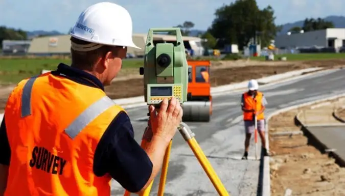
Image source: BLAZE Design Inc.
Finding a point’s three-dimensional or terrestrial location, as well as the separation and angle between it and other locations, is the process of surveying, often known as land surveying. Being a land surveyor entitles you to professional status in the industry. Moreover, these are often encountered locations on the surface of the Earth that are used for a variety of purposes, including the planned placement of building structural elements or the surface position of underground objects, as well as for the creation of maps and borders for property ownership.
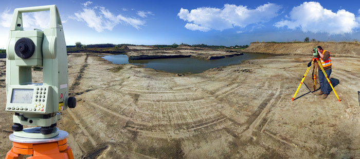
Surveying involves the use of physicists, statisticians, engineers, geometers, trigonametrists, mathematicians, and statisticians. These surveying experts rely on a range of instruments, such as theodolites, robotic theodolites, total stations, LiDAR sensors, radios, inclinometers, portable tablets, optical and digital levels, subsurface locators, drones, GIS, and other surveying software.
Also read: Civil Engineering Project Help from Professionals at an Affordable Price
Importance of Surveying in Construction Projects

Image source: The Constructor
Planning and carrying out any construction project requires a solid understanding of construction surveying. Moreover, surveying is an essential first phase in project execution that helps in error-free project management. Given below is a list of construction surveying’s importance in projects:
- The plan and design of all civil engineering projects, including building, roads, bridges, railroads, irrigation canals, reservoirs, tunnelling, irrigation, dams, and sewage works, are helped by the data measurements obtained by surveying.
- Conducting a survey assists in identifying a project’s high-risk locations and hazards.
- To initiate the conceptualization of an architectural design, surveying helps in the preparation of measuring data, including the terrain of the site, nearby structures, locations, and sources.
- The preparation of contour surveys, drainage path establishment, and correct soil profile knowledge are all supported by surveying.
- The plan and map of the project’s area sometimes referred to as the borders (legal boundaries), are created by surveying.
- The proper site for road building projects, as well as the best places for curves, materials, and techniques, are all determined with the use of surveying.
- A town’s flexible land zone for building roads, railroads, cables, drinking water plans, etc. is determined by surveying the area.
- While survey results are in favour of project implementation, we can promptly pinpoint any obstacles as soon as possible.
In addition to this, if you are a civil engineering student studying in the US and struggling with complex assignments, you can seek our assignment help in the US. We can assist you in composing accurate homework that will help you attain good grades.
Types of Construction Surveying
Various construction surveying techniques exist, depending on the goal and type of surveying. Every surveying technique has a unique purpose in engineering. They are used in management, environmental research, building, and other fields. In general, there are two categories of surveying: plane surveying and geodetic surveying.
What is geodetic surveying?

Image source: Leslie & Thompson
It is used to pinpoint precise locations and reference points. Moreover, it entails measuring substantial portions of the Earth’s surface. Furthermore, this surveying makes use of spherical trigonometry. Devices such as Total Stations and Global Navigation Satellite Systems are used in it. Also, it is more accurate than plane surveying and requires a careful study of the data.
What is plane surveying?

Image source: Construction World – Weebly
Less than 250 square km are covered by this type of surveying. It takes the Earth’s curvature into account and assumes a flat surface. Moreover, small-scale initiatives and area mapping are two uses for it. Furthermore, levels are used to measure vertical distances, and tape or chain is used to measure horizontal distances. Theodolite, Tacheometry, Levels, and other equipment are used in this method.
Additionally, if the theory of the subject is making you confused and leaving you with little time for practical learning, make sure to seek assistance from assignment experts. Delegating your work with professionals will be the best choice as you can focus on learning without worrying about the quality of your homework.
Also, based on several variables, surveying can be divided into several categories. Some of these are as follows.
On the basis of purpose
- Geodetic surveying
- Topographic surveying
- Cadastral surveying
- Construction Surveying
- Mining Surveying
- Hydrographic surveying
Based on the surveyed area’s nature
- Land Surveying
- Marine Surveying
- Aerial surveying
On the basis of the instruments used
- GPS surveying
- Total station surveying
- Leveling surveying
Based on the method used
- Triangulation
- Trilateration
- Remote sensing
Also read: Civil Engineering Assignment Help in the UK
Common Construction Surveying Errors and Tips to Avoid Them

Any construction project must include the process of surveying since it guarantees the precision, alignment, and security of the structures and the site. But construction surveying can also be prone to mistakes and oversights, which can lead to expensive delays, more work, and legal problems. Let us read about these mistakes one by one and ways to cope with the problems.
Defective instruments
Using faulty or inadequate equipment for surveying activities is a typical surveying mistake. The precision, dependability, and productivity of surveying operations might be jeopardized by malfunctioning equipment. Moreover, the extent, quality, and usefulness of the surveying data and findings may be constrained by improper tools. To prevent this, surveyors should select the appropriate equipment for the surveying demands, maintain and update their equipment on a regular basis, and inspect and calibrate their equipment before and after each use.
Disregarding amendments
The failure to consider or account for any changes that may arise during a construction project is another common surveying error. Modifications to the design, site adjustments, weather, or unanticipated events are examples of changes. The validity, relevance, and applicability of the construction surveying data and results may be impacted if these changes are disregarded or not taken into consideration. The project stakeholders should be notified and consulted, surveyors should keep an eye on and record the changes, and they should update and amend their surveying work accordingly.
Unskillful planning
Not having a thorough and well-defined plan before beginning work is one of the worst surveying blunders. Poor planning can result in time and resource waste, as well as confusion and inconsistency. A well-crafted plan needs to encompass the surveying task’s objectives, scope, standards, methodologies, equipment, and quality control procedures. Conditions at the site, any dangers, and backup plans should also be considered.
Unskillful planning might cause you trouble in any aspect of life especially academically. Hence, we have brought you solutions for multiple academic stress-causing issues. When you are struggling with assignments, you have our assignment writing solutions. But what if you struggle during your online courses or classes? For that, you have our online class help services available where you can hire experts to take your classes on your behalf keeping your internet security in mind.
Human error
Surveying with human error is a fourth common surveying mistake. Misreading, computing, interpreting, or reporting survey data and results are examples of human error. Inattention, exhaustion, and carelessness can also lead to human errors. Moreover, surveyors should use software and tools to help them, double-check their work, seek peer review and validation, and adhere to surveying standards and best practices to prevent this.
Poor communication
Ignoring to communicate with project stakeholders, including contractors, engineers, architects, clients, and authorities, is another common surveying error. Uncertainties, disputes, and inaccuracies in the survey’s data and findings might emerge from poor communication. Surveyors can prevent this by creating clear and frequent channels of communication, recording, and disseminating survey data, and asking pertinent parties for confirmation and comment.
Construction Surveying Fundamental Questions
Select the single best answer for each question or statement. 14.3 points for each question. The student must pass at least 80% or answer 8 questions correctly using the textbook Surveying with Construction Applications by Barry F. Kavanagh. Moreover, you can also find PDFs on the internet.
Section: 1
Question: 1 The key components provided by a surveyor hired to do the layout for the construction of a federal highway are:
A-horizontal and vertical angles
B- centre line station locations
C-line and grade for construction of the highway
D-roadway allowance stakes for right-of-way clearing
Answer: C-line and grade for construction of the highway
Question: A construction surveyor using steel tape is pulling a critical measurement for the layout of a building. The terrain in the immediate area does not allow for a level measuring area. If the surveyor verifies the difference in elevation between the point measured from, and the point measured to as 8.93 feet, and the measurement pulled along the sloped ground is 82 feet, 41/2 inches, what would the horizontal distance between the two points be? Show calculation process.
a-82.38 feet
b-82.86 feet
c-73.45 feet
d-81.89 feet
Answer: Given
- Elevation difference (ℎh) = 8.93 feet
- Sloped distance (?L) = 82 feet 4.5 inches
Firstly, we need to convert the sloped distance to a single unit (feet).
4.5 inches = 4.512124.5 feet = 0.375 feet
So, the sloped distance ?L is: ?=82+0.375=82.375 feetL=82+0.375=82.375 feet
Using the Pythagorean theorem: ?2=?2+ℎ2L2=d2+h2 where ?d is the horizontal distance.
Rearrange to solve for ?d: ?=?2−ℎ2d=L2−h2
Substitute the given values: ?=82.3752−8.932d=82.3752−8.932 ?=6785.140625−79.7249d=6785.140625−79.7249 ?=6705.415725d=6705.415725 ?≈81.89 feet≈81.89 feet
Therefore, the horizontal distance between the two points is:
d) 81.89 feet
Section: 2
Question: 3 Using an automatic level and rod, a construction surveyor shoots a backsight reading of 8.93 at a TBM of elevation 653.24. If the surveyor needs to mark elevation 649.21 on an existing wall for a carpenter to use as a reference line during construction, what should the rod reading be when marking the elevation? Show calculation process.
a-13.05
b-4.8
c-4.13
d-12.06
Answer: Determine the Height of Instrument (HI):
HI=Elevation of TBM + Back Sight (BS) reading
HI=653.24+8.93=662.17
Calculate the rod reading for the desired elevation (649.21):
Rod Reading=HI−Desired Elevation
Rod Reading=662.17−649.21=12.96
Hence, the answer is 12.96 or the nearest 12.06
Question: 4 When laying out an angle with a transit after the instrument is set up on a known point and a line of sight is established with another known point, the instrument angle should be:
a-set to 90 degrees
b-set to zero
c-ignored
d-set to 180 degrees then flipped.
Answer: b-set to zero
Section: 3
Question: 5 When turning the last angle of a closed traverse, the optimum result is:
a-to be 90 degrees from the origin
b-to measure exactly 360 degrees on the total station
c-to be sighting the first property corner previously installed
d-to be within 5 degrees of the first property corner installed.
Answer: b-to measure exactly 360 degrees on the total station
Question: 6 When using GPS to conduct coordinate point installation, a faulty layout point can most likely be attributed to:
a-space shuttle interference
b-improper receiver positioning
c-covert Cold War interference by the Russians
d- the mean distance above sea level.
Answer: b-improper receiver positioning
Question: 7 When conducting the layout of a highway curve, the most essential points necessary for doing the layout of any curve are:
a-the TBN and the HI.
b-the PI, BC and EC.
c-the BS and FS
d-X, Y, and Z.
Answer: b-the PI, BC and EC.
Section: 4
Question: 8 When reviewing a typical municipal street cross-sectional drawing, the crown, or cross fall of 2% is:
a-indicated only as a remember that the street is not to be installed flat.
b- the only way roads can be constructed, especially in wet climates.
c-necessary with respect to curve alignment at roadway intersections
d-critical with respect to grade control to ensure proper roadway drainage.
Answer: d-critical with respect to grade control to ensure proper roadway drainage.
Question: 9 Offset point installation is often used for the construction layout control of bridge foundations due to:
a-excavation depth at the foundation corner points.
b-the high volume of traffic at bridge locations
c-critical elevation verification
d- The long span of bridge beams prior to the final paving
Answer: c-critical elevation verification
Question: 10 When doing graphical analysis for an asphalt quantity survey, an area with four unequal sides, with two of them parallel, would more than likely be treated as what type of geometric
a-A triangle
b-A trapezoid
c-A square
d-A circle
Answer: b-A trapezoid
Future Trends in Construction Surveying
The field of land surveying advances along with technology. Not only is land surveying becoming more complex due to technological developments, but so is the location and personnel involved in the operation. Fewer people now do more work in the office than in the past. That does not, however, imply that the industry is contracting. According to the US Bureau of Labor Statistics, there will be an increase in demand for licensed surveyors by 800 jobs over the next ten years. Considering this, job prospects in the field are abundant even though field teams are getting smaller.
Furthermore, technological advancements are making the sector more accessible to persons with a broader and more diverse range of interests, and this does not exclude newer surveyors. GPS and drones, for example, have opened new prospects for qualified workers. Drone operators can use specialized software to compute the volume of aggregate stockpiles used in project materials management. The data is collected and transmitted to surveyors and engineers, who may calculate how much aggregate is available for future construction projects.
Therefore, even with conventional surveying, concentrations like geography, land management, and history remain necessary. Additionally, surveying students will encounter even more technology in the classroom, including robotics, artificial intelligence, mobile 3D mapping, and LiDAR, which is a type of 3D laser scanning.
Also, as mentioned above, you can now overcome your thoughts like who can take my online class for me, with our online class help services. So, what are you waiting for? Get started now!
Conclusion
In conclusion, any construction project can benefit from using construction surveying as a useful tool. They can help to increase safety on the job site by offering precise measurements. Although, they can be costly and time-consuming. The choice to employ construction surveys should ultimately be made considering the requirements of the project.
Frequently Asked Questions
| Question: In surveying, what is a layout? Answer: The ability to define precise positions for above- and below-ground structures is known as a construction layout. Setting out is the part of surveying that involves a team transferring a plan from building drawings onto the ground. Walls, limits, edge slabs, and other location points are shown. |
| Question: Could a career in surveying be fulfilling? Answer: Yes, land surveying is a fantastic career choice. In several sectors, including real estate, infrastructure development, urban planning, and construction, surveyors are essential. |
